
U.S. Atlantic Coast,
Long Island Sound to Cape Cod Canal
Chart List, & Enlarged View
See bottom of page for ordering information
All NOAA Nautical Charts are $20.75 each
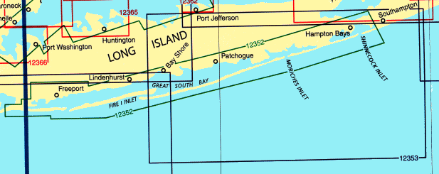
| Qty |
Chart # |
Description |
Scale |
|
12354 |
Long Island Sound, Eastern Part |
1:80,000
|
|
12358 |
New York-Long Island, Shelter Island Sound and Peconic Bays
Mattituck Inlet |
1:40,000
1:10,000
|
|
12362 |
Port Jefferson and Mount Sinai Harbors |
1:10,000
|
|
12363 |
Long Island Sound Western Part |
1:80,000
|
|
12364-SC |
Long Island Sound Folio, New Haven Harbor Entrance
and Port Jefferson to Throgs Neck |
1:40,000
|
|
12365 |
Sound South Shore of Long Island, Oyster and Huntington Bays |
1:20,000
|
|
12366 |
Long Island Sound and East River |
1:20,000
|
|
12367 |
North Shore of Long Island Sound, Greenwich Point to New Rochelle |
1:20,000
|
|
12368 |
North Shore of Long Island Sound, Sherwood Point to Stamford Harbor |
1:20,000
|
|
12369 |
North Shore of Long Island Sound, Statford to Sherwood Point |
1:20,000
|
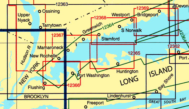
| Qty |
Chart # |
Description |
Scale |
|
12370 |
North Shore of Long Island Sound, Housatonic River and Milford Harbor |
1:20,000
|
|
12371 |
New Haven Harbor
New Haven Harbor (inset) |
1:20,000
1:10,000
|
|
12372-SC |
Long Island Sound Folio, Watch Hill to New Haven |
1:40,000
|
|
12373 |
North Shore of Long Island Sound, Guilford Harbor to Farm River |
1:20,000
|
|
12374 |
North Shore of Long Island Sound, Duck Island To Madison Reef |
1:20,000
|
|
12375 |
Connecticut River, Long Island Sound to Deep River |
1:20,000
|
|
13277 |
Connecticut River, Deep River to Hartford |
1:20,000
|
|
13278 |
Connecticut River, Bodkin Rock to Hartford |
1:20,000
|
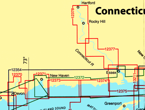
| Qty |
Chart # |
Description |
Scale |
|
13205 |
Block Island Sound and Approaches |
1:80,000
|
|
13209 |
Block Island Sound and Gardiners Bay
Montauk Harbor |
1:40,000
1:7,500
|
|
13211 |
North Shore of Long Island Sound, Niantic Bay and Vicinity |
1:20,000
|
|
13212 |
Approaches to New London Harbor |
1:20,000
|
|
13213 |
New London Harbor and Vicinity
Bailey Point to Smith Cove |
1:10,000
1:5,000
|
|
13214 |
Fishers Island Sound |
1:20,000
|
|
13215 |
Block Island Sound, Point Judith to Montauk Point |
1:40,000
|
|
13217 |
Block Island |
1:15,000
|
|
13218 |
Martha s Vinyard to Block Island |
1:80,000
|
|
13219 |
Point Judith Harbor |
1:15,000
|
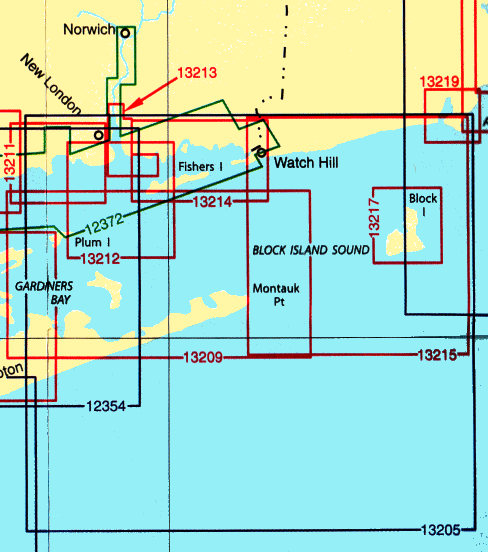
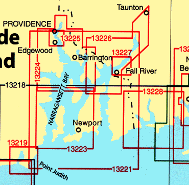
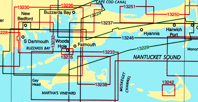
All NOAA Nautical Charts are $20.75 each
Other NOAA and DMA Publications
Now Available

Print on Demand Charts
Please Note:
With all the recent cases of on-line credit card and Identity theft,
we feel obliged to inform our customers that neither
C.G. Edwards Co Inc. or Boxell's Chandlery,
under any circumstance sell or divulge any personal information about our customers,
nor do we in any way store confidential information on our server.
Please be assured that we will continue to do everything within our power to keep any
information submitted by our customers as secure as we possibly can.
|
| Please select the products and/or enter the number of units required. On JavaScript-enabled browsers the display table will be automatically updated. Such display is for information only and is not essential for the operation. You can select any number of items prior to adding to the shopping cart. It is not necessary to add each item to the cart as they are selected. However, if the products are in the form of a simple or dropdown list, and JavaScript is NOT enabled, then you must add each item to the cart individually.
|
 Boxell's Chandlery