
U.S. Atlantic Coast,
Cape Hatteras to Delaware River
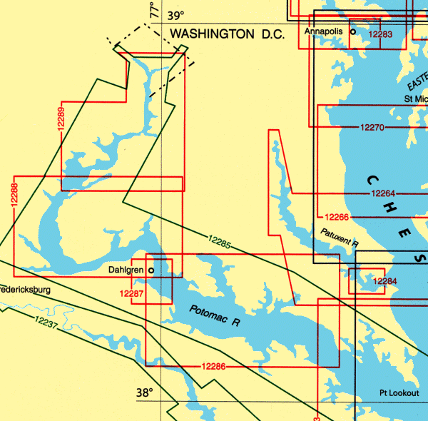
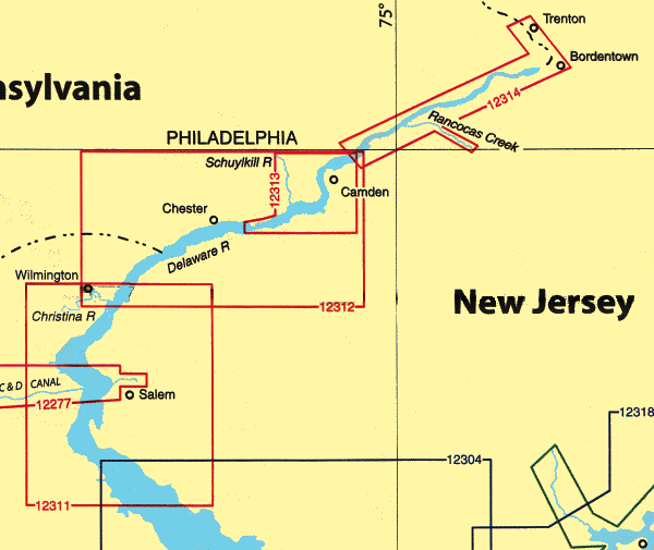
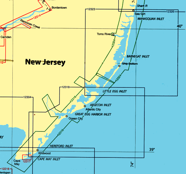
Chart List, & Enlarged View
See bottom of page for ordering information
All NOAA Nautical Charts are $20.75 each
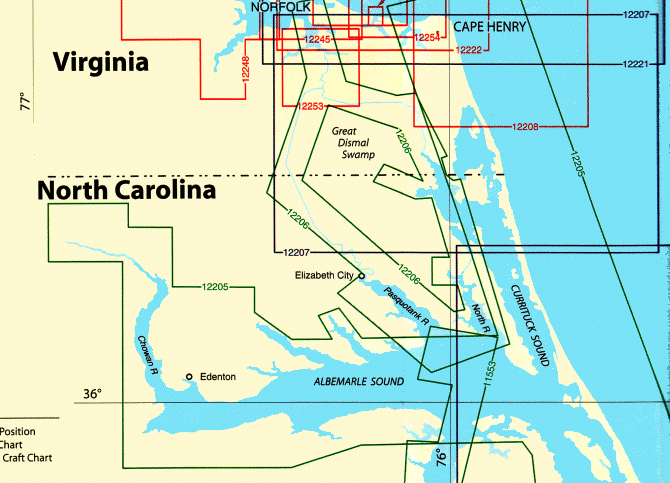
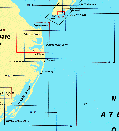
| Qty |
Chart # |
Description |
Scale |
|
12221 |
Chesapeake Bay Entrance |
1:80,000
|
|
12222 |
Chesapeake Bay, Cape Charles to Norfolk Harbor |
1:40,000
|
|
12224 |
Chesapeake Bay, Cape Charles to Wolf Trap |
1:40,000
|
|
12225 |
Chesapeake Bay, Wolf Trap to Smith Point |
1:80,000
|
|
12226 |
Chesapeake Bay, Wolf Trap to Pungoteage Creek |
1:40,000
|
|
12228 |
Chesapeake Bay, Pocomoke and Tangier Sounds |
1:40,000
|
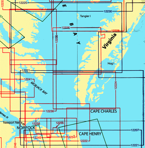
| Qty |
Chart # |
Description |
Scale |
|
12230 |
Chesapeake Bay, Smith Point to Cove Point |
1:80,000
|
|
12231 |
Chesapeake Bay, Tangier Sound, Northern Part |
1:40,000
|
|
12233 |
Potomac River, Chesapeake Bay to Piney Point |
1:40,000
|
|
12235 |
Chesapeake Bay,
Rappahannock River Entrance Piankatank and Great Wicomico Rivers |
1:40,000
|
|
12237-PF |
Rappahannock River, Corrotoman River to Fredericksburg |
1:40,000,
1:20,000
|
|
12238 |
Mobjack Bat to York River Entrance |
1:40,000
|
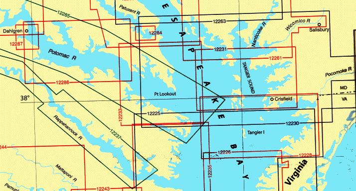
| Qty |
Chart # |
Description |
Scale |
|
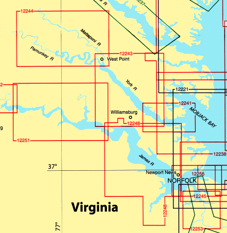
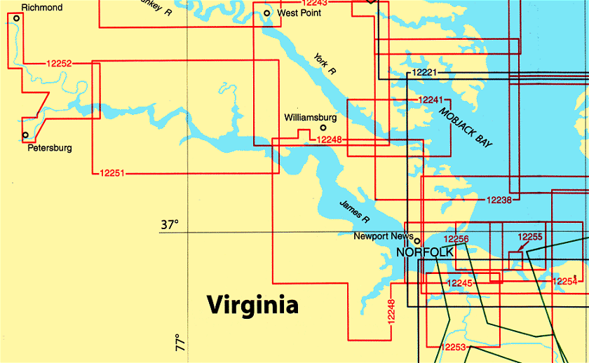
12251 |
James River, Jamestown Island to Jordan Point |
1:40,000
|
|
12252 |
James River, Jordan Point to Richmond |
1:20,000
|
|
12253 |
Norfolk Harbor and Elizabeth River |
1:20,000
|
|
12254 |
Chesapeake Bay, Cape Heny to Thimble Shoal |
1:20,000
|
|
12255 |
Little Creek, Naval Amphibious Base |
1:5,000
|
|
12256 |
Chesapeake Bay, Thimble Shoal Channel |
1:20,000
|
| Qty |
Chart # |
Description |
Scale |
|
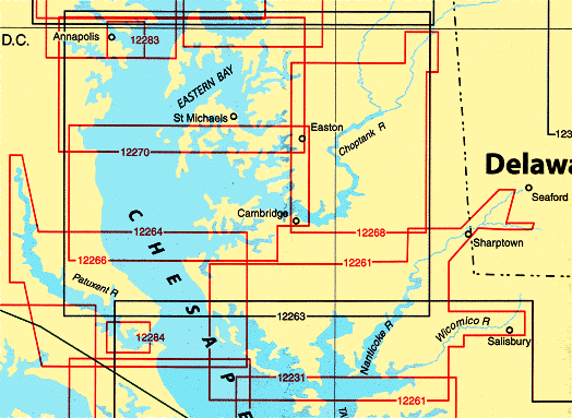
12261 |
Chesapeake Bay, Hanga, Nanticoke, Wicomico Rivers & Fishing Bay |
1:40,00
|
|
12263 |
Chesapeake Bay, Cove Point to Sandy Point |
1:80,000
|
|
12264 |
Chesapeake Bay, Pax River and Vicinity |
1:40,000
|
|
12266 |
Chesapeake Bay, Choptank River and Herring Bay |
1:40,000
|
|
12268 |
Chesapeake Bay, Choptank River, Cambridge to Greensboro |
1:40,000
|
| Qty |
Chart # |
Description |
Scale |
|
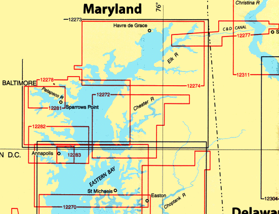
12270 |
Chesapeake Bay, Eastern Bay and South River
Selby Bay |
1:40,000
1:20,000
|
|
12272 |
Chester River, Kent Island Narrows |
1:40,000
|
|
12273 |
Sandy Point to Susquehanna River |
1:80,000
|
|
12274 |
Head of Chesapeake Bay |
1:40,000
|
|
12277 |
Chesapeake and Delaware Canal |
1:20,000
|
|
12278 |
Approaches to Baltimore Harbor |
1:40,000
|
|
12281 |
Baltimore Harbor |
1:15,000
|
|
12282 |
Severn and Magothy Rivers |
1:25,000
|
|
12283 |
Annapolis Harbor |
1:10,000
|
All NOAA Nautical Charts are $20.75 each
Other NOAA and DMA Publications
Now Available

Print on Demand Charts
Please Note:
With all the recent cases of on-line credit card and Identity theft,
we feel obliged to inform our customers that neither
C.G. Edwards Co Inc. or Boxell's Chandlery,
under any circumstance sell or divulge any personal information about our customers,
nor do we in any way store confidential information on our server.
Please be assured that we will continue to do everything within our power to keep any
information submitted by our customers as secure as we possibly can.
|
| Please select the products and/or enter the number of units required. On JavaScript-enabled browsers the display table will be automatically updated. Such display is for information only and is not essential for the operation. You can select any number of items prior to adding to the shopping cart. It is not necessary to add each item to the cart as they are selected. However, if the products are in the form of a simple or dropdown list, and JavaScript is NOT enabled, then you must add each item to the cart individually.
|
 Boxell's Chandlery